The Peloponnese
Since we have come across to Patras, we are on the Peloponnese.


The Peloponnese is a peninsula and constitutes the most southern part of mainland Greece.
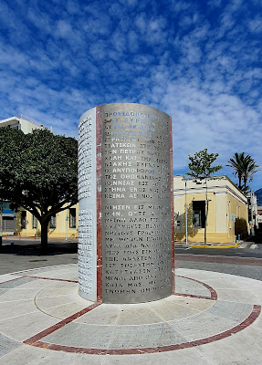
It is connected to the mainland only by a few bridges. One you saw last week, the others are located on the Isthmus of Corinth, a narrow land bridge near Corinth. The isthmus separates the Gulf of Corinth from the Saronic Gulf.
The canal concept originated in the 7th Century AD, but building wasn`t undertaken until 67 AD under Roman Emperor Nero, who put Jewish prisoners of war to work.
Construction ceased shortly after Neros death and was never picked up again until 1891.
The first ships passed in July 1893.
The hoped for economic significance never came to pass, since the 6,3km long canal is only 25m wide and was soon outgrown by modern ships. The Panama Canal it is not.
You will see some pictures when we get there.
But first, we were off into the mountains to the small village of Dimitsana, from where you can do a nice hike through the Lousios Gorge, which also takes you past some old and scenic monasteries.
For me, this mountain driving is slightly stressful. I have to be vigilant like a hawk on these narrow winding roads. But the scenery is indeed stunning.
 |
| Traffic in the mountains |


Why would you do that?


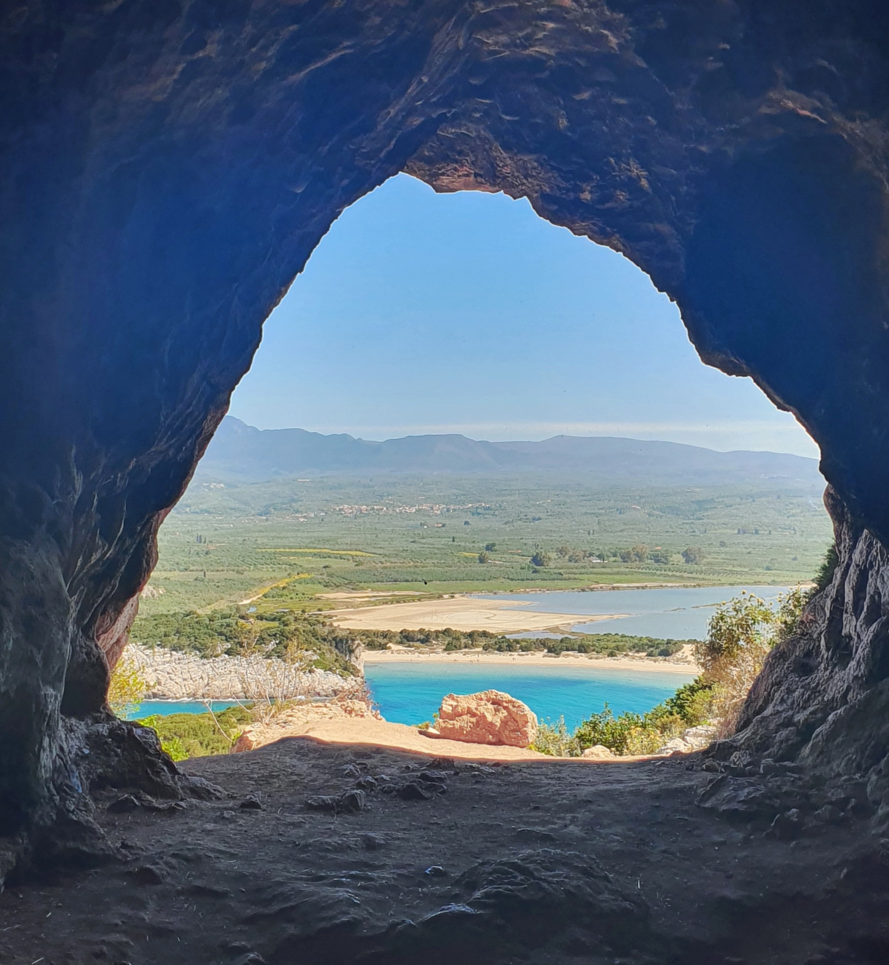
Coming back down from the mountain, we stopped in the Gialova wetlands, a place of remarkable natural beauty and one of the important bird areas in Europe.
Part of the area is the Bay of Voidokilia, whose cove-shaped beach is regularly ranked as one of the most beautiful in the world.
To get a good look at it from all sites, my human embarked on a 12km hike that took her all the way around the wetlands.

 |
| Paliokastro, 13th Century, overlooking the bay |


 |
| Voidokilia (Ochsenbauchbucht in German, Bulls Belly Bay) |
 |
| Nestor`s cave, where, according to myth, Hermes hid the cattle stolen from Apollo |
 |
| The beach is presumed to be Homer`s "sandy Pylos" where Telemachus was welcomed by King Nestor when searching for his father, Odysseus |


A couple of waterfalls in the area
The following night was a bit noisy, due to the three very outspoken street dogs hanging around the stretch of beach we made our camp at for the night. No amount of treats would shut them up. But take `em they did, and gladly.
 |
| These guys were happy about a little treat as well |
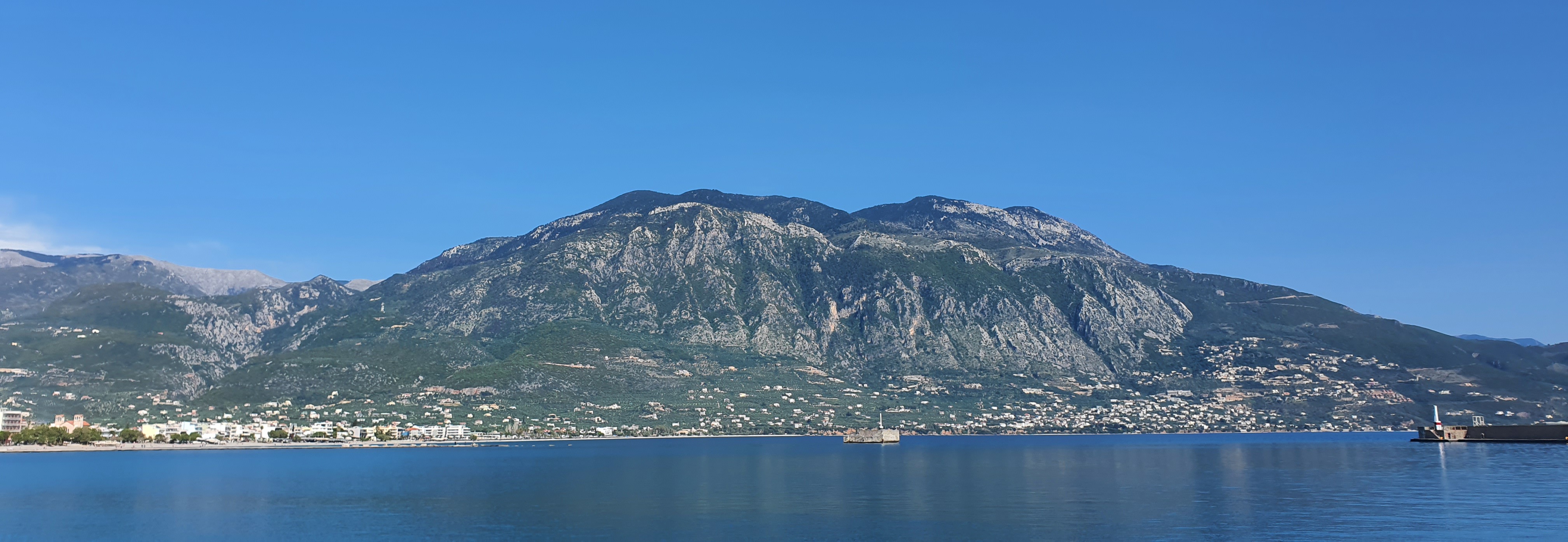
Kalamata was our next stop. Yes, that is where all your olives come from.
Around 20% of the total table olive production of Greece comes out of Kalamata, some 30.000 tons a year! That`s around 5000 African elephants!
Besides that, there really isn`t that much to say about Kalamata. The rather uninspiring ruins of a 13th century castle sit on a low hill, the streets of the old town are lined with clothing shops and an absurd number of shoe retailers.


 |
| Possibly the best thing in Kalamata, the mountain view |


 |
| A solar powered charging bench |


In a small park you find an open air museum for old trains.
Very handy is the nice bicycle lane running along the waterfront. Just watch the waiters who have to cross the road to get from the restaurants to the water-side tables.


With the many (small) mountains backing up against the city, it was no wonder my human took off on a long hike. Good training for a bigger one she has planned on climbing at the end of the week.


 |
| See the one with snow on top? A bit off center to the right? That`s the next one. |
Driving out of Kalamata, we were soon on the Mani Peninsular.
It is the central of the three peninsulas extending south from the Peloponnese.
The inhabitants of this region, the Maniots claim descent from the ancient Spartans.
 |
| Driving along the Mani Peninsular |


 |
| These stone houses are typical for the region |

Until recent years, many villages were only accessible by sea. Today, a narrow winding road extends along the west coast.
The capital of the region Areopoli, which translates to "City of Ares", the ancient Greek god of war.
Thankfully, people in the small town seemed friendly enough.
 |
| One door for small people and one for very small people |
 |
| Areopoli |
 |
| This watch dog is taking his job seriously |


The next day, we drove to Cape Tainaron, the most southerly point of mainland Greece. Although, as you now know, strictly speaking, the Peloponnese is a peninsular. But since that is a man-made fact, it still counts.
From the car park it`s a pleasant 40 minute walk to the lighthouse at the end of terra firma.
The water depth right off the point here is 4000m!
 |
| On the way to the Cape |
 |
| One of a number of ghost towns scattered in these mountains |


Right next to the parking area is the entrance to Hades, the underworld in Greek mythology.
Hades, the god of the dead, is it`s ruler and his name became synonymous with the place.
He is the brother of Zeus, who rules the sky, and Poseidon, king of the sea. The earth is shared by the all three.
Unfortunately, there wasn`t really anything to see at all, just undergrowth and scrub. What a shame!
 |
| Not sure under which bush to search for the entrance to Hades... |
 |
| It should have been right there |
We parked up for the night right next to a nice beach, where, since1981, you can walk right up to the wreck of the Denmark built Klintholm, a 67m freight ship, which was acquired by a Greek company and renamed Dimitrios.
After being declared unsafe, she was moored in the nearby town of Gythio, from where she broke free during a storm in 1981.
The ghost ship sailed aimlessly throughout the Laconian Gulf for over a month, before becoming stranded on this beach.
 |
| Little stroll in Gythio along the was |


On we went to one of the oldest continually-inhabited fortified towns in Europe, Monemvasia.
Founded in the 6th Century, the town is the site of a once-powerful medieval fortress and was at one point one of the most important commercial centers in the Eastern Mediterranean.
You woulnd`t think any of this, since from afar it looks like an island that mainly consists of a huge rock and was connected to the mainland as recent as 1971.
Once you get over there, though, prepare to be amazed. Both, the ruins on top of the rock as well as the "new" village are beautiful.


Random wildlife

To finish off the week, my human climbed the highest point of the Peloponnese, Profitis Ilias, 2407m, in the Taygetos mountain range.
Although there was some cloud cover and fog around the summit, it was a fine 22km hike with 1600 hight meters.
 |
| Early start with the sunrise |
 |
| Taygetos massif |


I don´t think so.

 |
| A church without a roof |


No roof, therefore plenty of snow


Excellent overview of Peloponnese Tours! I love how this guide highlights the region's history, scenic landscapes, and authentic Greek culture. It's a valuable resource for anyone planning an unforgettable trip to Greece.
ReplyDeleteWonderful post! It beautifully showcases why Peloponnese Tours are perfect for travelers seeking ancient history, breathtaking landscapes, and authentic Greek culture.
ReplyDeleteThe practical insights and travel inspiration make planning a memorable journey through the Peloponnese much easier. Great resource for first-time and returning visitors alike!